|
From the West Side of Manhattan: From New York City, take the West Side Highway / Henry Hudson Parkway heading north. It will soon turn into the Saw Mill River Parkway. Continue on the Saw Mill Parkway heading north until its end where it joins up with Route 684 heading north. Take Route 684 north to its end where it joins up with Route 22 north. Take Route 22 north towards Wingdale.
In
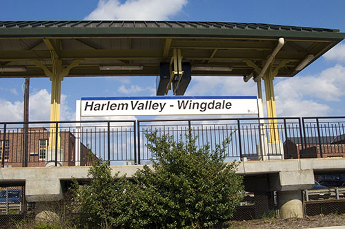
Wingdale, about a half-mile (0.5 mile) after passing the "Harlem Valley - Wingdale"
train station on your left (at the traffic light) at the intersection
of Route 22/55 and Wheeler Road leave Route 22
and take Route 55
eastbound by veering right at the fork in the road and begin carefully looking for signs to Camp Ramah.
You will now be about 3.5 miles from Camp Ramah.
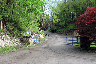
Please read carefully; - In about a quarter-mile (0.25 mile), bear right at the fork to stay on Dutchess County Route 6 / Old Route 22. - After about a quarter-mile (0.25 mile) or so, there is a concrete bridge that passes over a small river (large stream?) on your right. Turn right onto the concrete bridge which will put you onto "Reagans Mill Road". - In a little more than a half-mile (0.5 mile) bear left at the small triangle (three roads coming together). This will put you onto "Berkshire Road". - In about a half-mile (0.5 mile), turn right onto Weil Road (before the entrance to Camp Berkshire which is straight ahead). The sign for Weil Road may say "Weils Road" instead of Weil Road (I think the sign maker got it wrong). - In about two-tenth's of a mile (0.20 mile), bear left at the fork (away from Weil Road). You will now be on a road marked either St. George Road or Ramah Road (either one is fine). - In another one-tenth of a mile (0.10 mile), turn right onto Ramah Road (St. George Road will go straight at this point and may have a sign stating "Dead End"). Please be careful on this section of Ramah Road as it is narrow, unpaved, twisty, has multiple blind turns and is a two way street (there could be oncoming traffic). The camp is at the end of this road (about a quarter (0.25) mile), you can't miss it!
The trip from the Upper West
Side is about 74 miles and takes 1.5+ hours if there is normal (non-rush hour) traffic.
From the East Side of Manhattan:
Take the Major Deegan
Expressway to Route 87 North.
Exit at Cross Westchester Expressway (Route 287) East.
Take it until the exit for Route 684 north (Brewster).
Take Route 684 as described above.
From New Jersey: Take the Garden State Parkway North to the New York State Thruway south. Cross the Tappan Zee Bridge and take the Saw Mill River Parkway north as described above.
From Long Island: Take the Bronx Whitestone Bridge into Hutchinson River Parkway north into Route 684 north to Brewster. Take Route 684 as described above. From Boston: Take I-90 (Mass. Pike) West to Sturbridge. Take Exit 9 follow Route 84 West through Hartford to Danbury. Follow 84 West to Danbury and Take Exit 7 (Route 202 East / Route 7 North). Follow Route 7 North. After about 20 miles, make a left onto Route 55 West (Webatuck Road). After about 5 miles (during which you will cross the border into New York) make a right onto Dutchess County Route 6 which is also know as Old Route 22 at this point. Follow the directions as described above. IMPORTANT: Please note that using a GPS can, if approaching camp from the north or east, result in being routed to the camp's locked back gate. The back gate is far from the main area of camp and anyone who can unlock that gate. The reason this can happen is that the front and back gates have the same street address. You must drive in through the front gate. If you find yourself at the back gate then drive south (which is probably the way you came, along Lake Ellis Road) and then make a right turn onto Weil Road and then, at a three-way intersection, make a right and then soon-after, make another right onto Ramah Road. GPS Address: 72 Ramah Road, Wingdale, NY 12594
After getting to 72 Ramah Road just drive a little further
Click here for a map and/or personalized driving directions
Metro North offers train service on its Harlem Line from Grand Central Terminal in New York City to the “Harlem Valley – Wingdale” train station. Please note that many of the trains going from Grand Central Station to Wingdale involve a change of trains at some point along the way (typically in Southeast, ask the conductor if in doubt!). More information is available at www.mta.info, (212) 532-4900, or (800) 638-7646. This is the train schedule as
of May 14, 2019.
Click Here for Driving Instructions Between the Train Station and the Camp
Taxi Information There are a couple of taxi companies that can transport you from/to the Harlem Valley - Wingdale train station and Camp Ramah. As of May 2009 we knew of two (but in 2017 there may be others!). Please note that both need some advanced notice and are not always available to pick you up whenever you call. Optimally you should make a reservation the day before you need their services. As of May 2009 the cost was about $25 one-way. Please also note that the taxi companies may not know exactly where the camp is. You should tell them that it is 4.0 miles from the train station and that you have detailed driving directions (use the ones on this website).
Pawling Taxi: (845) 855-9800 |
||||||||||||||||||||||||||||||||||||||||||||||||||||||||||||

